Basei Glacier

Edited by:
Massimo Martini
Access
Reach the edge of the glacier by following the hiking route that climbs to Punta Basei from the Thumel car park in Val di Rhêmes (Valle d’Aosta): cross Col Nivolettaz (3,130 m, 3h 45' from the start) and Colle Basei (3,176 m, 4h00'), beyond which you walk alongside the edge of the glacier, without actually crossing it. The route then continues towards the summit of Punta Basei (3,338 m, 4h 30′), with a final section requiring mountaineering skills (II+); however, the edge of the glacier can still be reached without tackling this section. Alternatively, for the Nivolet area only, it is possible to drive from Ceresole Reale to Colle del Nivolet; traffic is regulated on Sundays in July and August.
Introduction
The Basei Glacier is situated in the municipality of Ceresole Reale, in Piedmont, within the Gran Paradiso National Park, on the Galisia-Entrelor-Bioula Ridge (Grande Sassière and Rutor Alps, Graian Alps). It extends across a broad north-north-east-facing slope, below Punta Basei (3,338 m) and Colle Basei, feeding the Rio Rosset, a tributary of the Orco. Listed as number 64 in the Italian Glacier Register, it is classified as a valley glacier. It has been retreating significantly for several decades.
Description
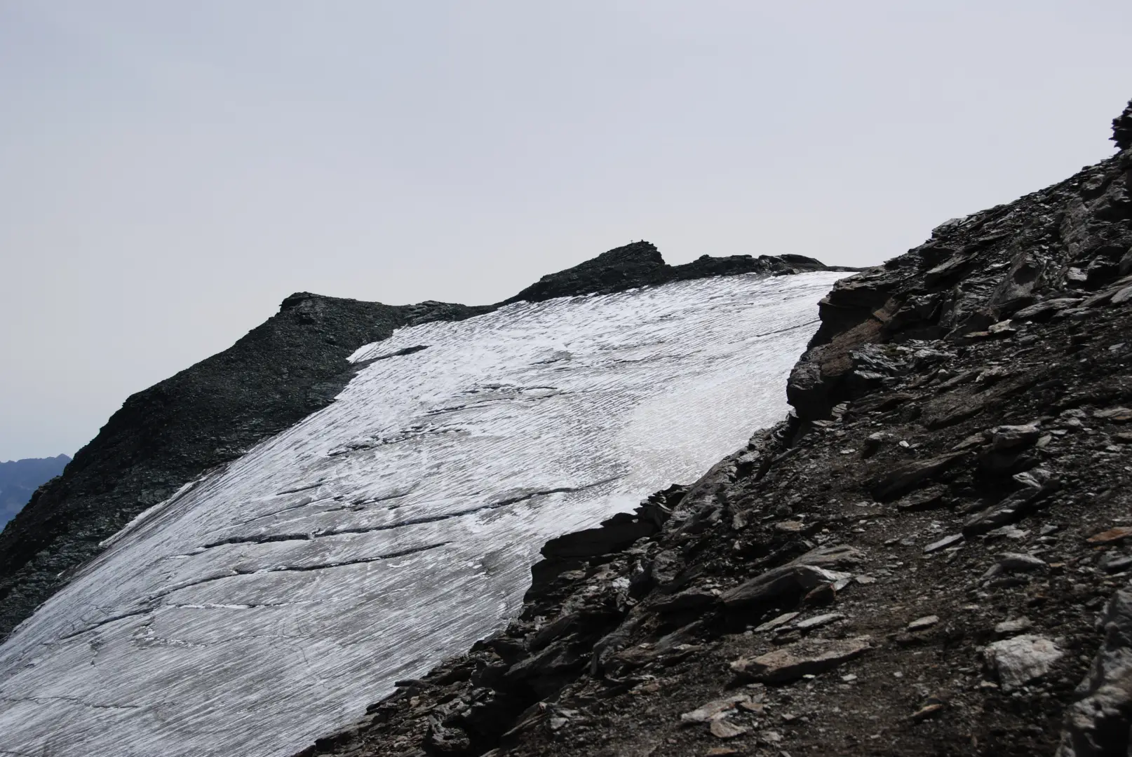
The Basei Glacier (Italian Glacier Register, Graian Alps, no. 64) extends across a steep slope, which becomes as steep as approximately 40° at its terminus, below Punta Basei and Colle Basei. The original survey for the Register (M. Vanni, circa 1959–61) recorded a length of 900 metres, a maximum width of 500 metres and an area of 28 hectares, with a maximum elevation of 3,300 metres and a minimum elevation at the front of 2,950 metres; the glacier was already noted as being “in significant retreat” at that time.
An inspection by the Italian Glaciological Committee on 11 September 1982 confirmed that the front was thinning, with a thickness of less than one metre in some sections. The Italian Glaciological Committee’s visit on 8 September 2009 documented a significant retreat compared with a photograph from 1928: the terminal tongue, which once hung over a rocky step, has completely disappeared, as have the northernmost sections of the glacier. The historic measuring marker (CL 59) was often unusable due to a persistent residual snowfield linked to the now concave profile of the glacier front; at the new marker (FL, established in 2006), a retreat of 4 metres was recorded in 2009 alone, bringing the cumulative retreat to 12.5 metres since 2006. The same survey also noted a further loss of ice thickness, the emergence of new rock outcrops and the formation of a subglacial cavity approximately 20 metres long. No quantitative surveys (area, length, front elevation) have been published since 2009: the dimensional values given above remain those of the original survey, which have now been superseded by documented facts but not replaced by new, verified numerical data.
The glacier is not crossed by the path leading up to Punta Basei, which is visible from the route near Colle Basei (3,176 m).
Information
General information
Official name and variants: Basei Glacier (also “Basei Glacier”; see C. Lesca, “The Basei Glacier", 1957)
Glaciological register code: Register of Italian Glaciers, CGI no. 64
Mountain group and subgroup (SOIUSA): Part: Western Alps · Major Sector: North-Western Alps · Section: Graian Alps · Subsection: Alps of the Grande Sassière and the Rutor · Supergroup: Grande Sassière-Tsanteleina Range · Group: Galisia-Entrelor-Bioula Range
Municipality, region, country: Ceresole Reale, Metropolitan City of Turin, Piedmont, Italy
Protected area: Gran Paradiso National Park
Predominant aspect: NNE
Type of glacier (Form): valley glacier. Note: the original entry in the 1959–61 Land Registry classified it as “Pyrenean (slope)” according to a historical typology no longer in use today, distinct from the three-part classification of valley, mountain and snow-glacier — noted for the sake of completeness, not necessarily in contradiction with the current classification.
Maximum and minimum elevation: 3,300 m (max) / 2,950 m (front) — 1959–61 Land Registry survey, essentially confirmed by the 1982 CGI survey. Historical data, over 60 years old: the 2009 survey documents significant retreat and loss of thickness but does not provide a new numerical elevation. No updated values found.
Area and length: 28 ha (0.28 km²); length 900 m; maximum width 500 m — same 1959–61 survey, not updated
Basin and watercourse: Rio Rosset → Orco → Po
Date of data update: dimensional survey 1959–61 (CGI Land Registry vol. II Piedmont, ed. M. Vanni); last quality check 2009 (CGI/Nimbus)
Visitor information
Warning: access to the glacier surface is a mountaineering activity, not a hiking activity, and is subject to crevasses and changing glacial conditions.
Points of interest
Punta Basei
Colle Basei
Links
Punta Basei, from the Savoia Mountain Hut.