Etirol

Access
Leave the motorway junction at Châtillon-Saint-Vincent, turn left and continue for 300 metres to the roundabout. Take the third exit onto Via Émile Chanoux and follow it for 600 metres through the historic centre of Châtillon. Turn slightly right onto Via Menabreaz and continue for 450 metres to the roundabout with the Matterhorn monument in the centre. Take the second exit and enter the Regional Road in the direction of Valtournenche. Continue on for 7.8 km until Antey-Saint-André, where you will come to the junction with Regional Road for Torgnon. Turn left and climb up the road for 6.4 km until you reach the main town of Mognod. Continue straight on, following the signs for the ski lifts. After 400 metres, at a hairpin bend to the left, turn right onto the municipal road, following the signs for Petit Monde, Triatel and Etirol. Continue along the narrow road until you reach the village of Triatel and finally that of Etirol, where there is a small car park 🅿️ near the village. If the car park is full, it is possible to turn around and park near the Moulin.
To reach the starting point of the route, private transport is indispensable, as it is not served by public transport.
Distance and journey time
🕒Travel time: 33 minutes
📏 Distance: 19.60 km
GPS navigation
📍 How to get there with Google Maps
📍How to get there with Apple Maps
ℹ️ Important note
The information provided was checked on the date of the route survey. Before departure, it is advisable to check for any changes to the route. For up-to-date and detailed directions, we recommend the use of Google Maps or Apple Maps.
Introduction
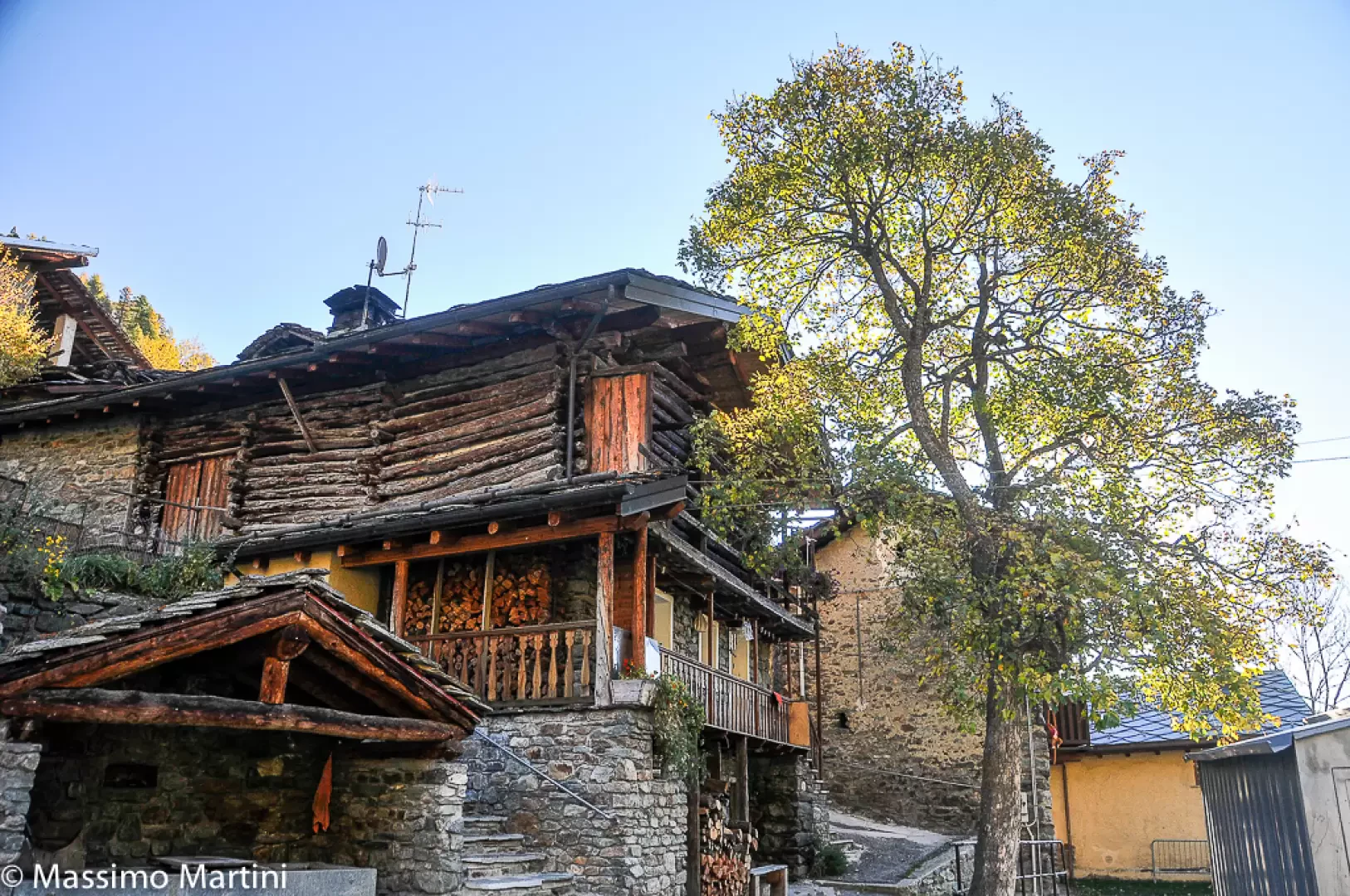
Étirol is a small Alpine village located at an altitude of 1,598 m, in the municipality of Torgnon, in Valle d'Aosta. Situated in a panoramic position on the side slopes of the Matterhorn valley, it overlooks the central furrow of the Valtournenche. The hamlet retains the typical layout of the mid-mountain hamlets of Valle d'Aosta, with stone and wooden houses, rascards and barns, and is the starting point for numerous hiking itineraries up the Petit Monde valley and the Comba di Chavacour.
.Description
The village of Étirol is one of the historic nuclei of Torgnon, embedded in the rural fabric of the valley and linked to the agro-pastoral tradition. The dwellings are built in local stone and wood, with slate roofs and balconies exposed to the sun, in keeping with the typology of mountain peasant architecture. Surrounding the village are meadows, pastures and larch forests, which once provided fundamental resources for the local economy.
The location of Étirol, on the edge of the Chavacour valley, makes it a strategic point for hikes of naturalistic and scenic interest: trails leading to the Loditor wetland plateau, the Tsan bivouac and the Fenêtre du Tsan, with possible connections to the Alta Via no. 1, start here. The area is characterised by habitats rich in biodiversity, with the presence of wetlands and peat bogs that are home to rare and typical floristic species of the Western Alps.
Information
Height: 1,598m
Alternative name: -
Populated:yes, all year round