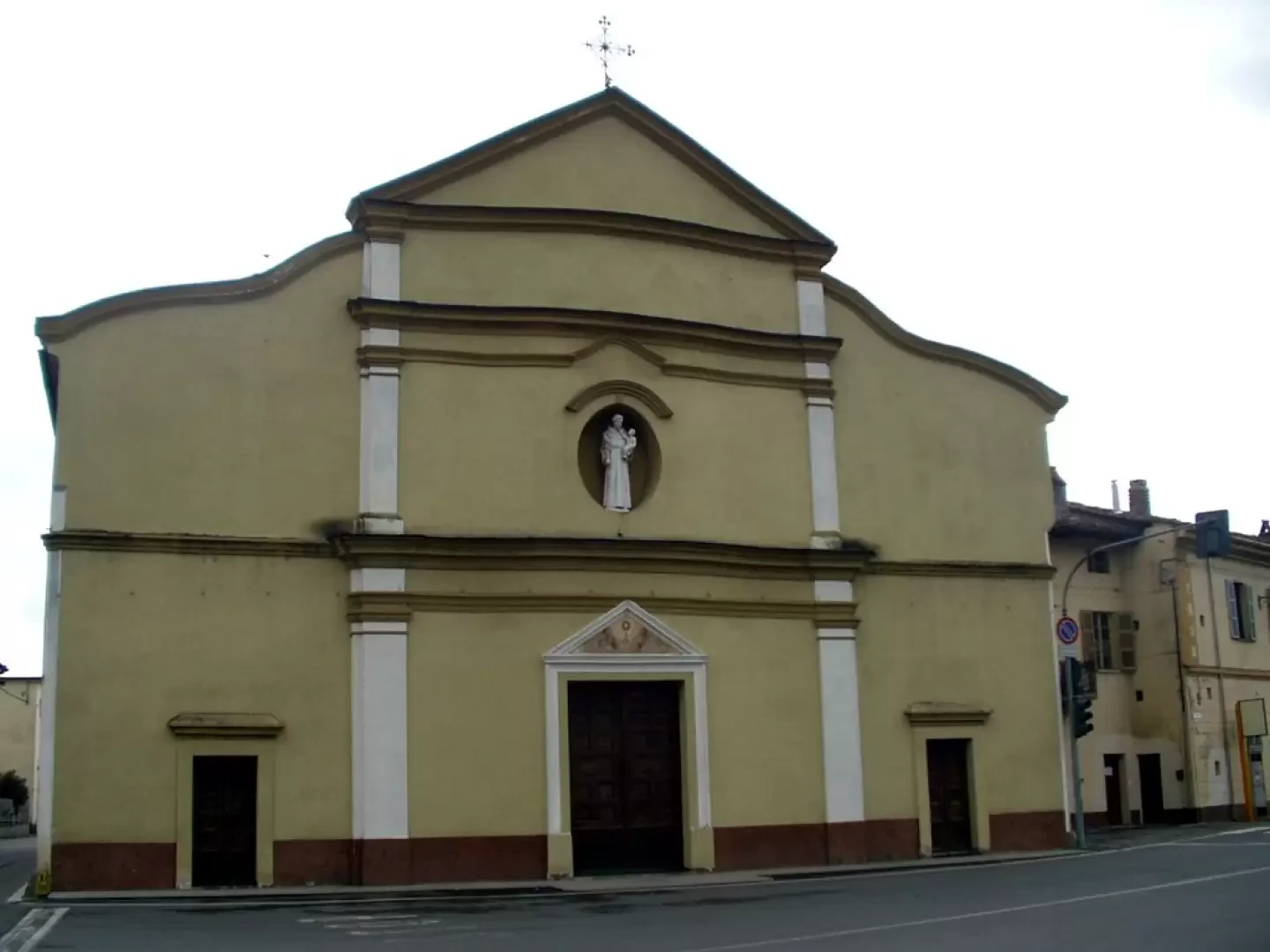
Cascinette d'Ivrea

Access
Access to the municipality is mainly via the state road linking Ivrea - just 5 km away - and the nearby towns of Biella and Santhià. Cascinette is well connected to the local road network and has parking areas at public areas and main points of interest. The nearest railway station is in Ivrea, while the reference airport is Turin Caselle, about 45 minutes by car.
.Introduction
Cascinette di Ivrea is a small municipality in the metropolitan city of Turin, located in the Piedmont region, on the outskirts of Ivrea, and nestled in the grandiose morainic amphitheatre of Canavese, one of the most impressive in Europe. The municipal territory, which covers an area of approximately 2.2 km², is predominantly flat, enriched by the presence of the Campagna Lake - a popular destination for families and fishermen - and bordered by the gentle contours of the hills at the foot of the Morainic Serra, the longest in Europe. The surrounding woods, together with the waterways of the Dora Baltea, have always favoured the agricultural development of the area, marking the settlement history of the town.
Description
The origins of the name 'Cascinette' refer to the term 'cassina' or 'cascina', in reference to the ancient cottages with thatched roofs, called 'bent', used by the people of Chiaverano as a support to cultivate their fields on the plain. Cascinette appears in documents around 1600, a period in which the presence of these cottages was gradually transformed into a permanent settlement. Between 1764 and 1770 the chapel dedicated to St Anthony of Padua was built, enlarged and became a parish church in 1834, while in 1925 the village gained autonomy from Chiaverano. Peculiar is the bell tower, built in 1863 on the top of Mount Sasso, moved about 200 metres from the church to allow the time to be read from every corner of the village.
The municipality has a history of agricultural and rural connections, with a gradual transformation into a residential area and constant collaborations with neighbouring Ivrea and Chiaverano. Although it does not host monuments of great importance, the community fabric is distinguished by its participation in the main Piedmontese and Canavese traditions. The patron saint's festival of Sant'Antonio is celebrated on 13 June, with events involving the entire village. In the area, the passage of the Via Francigena, in the Canavese variant, which runs along Lake Campagna and joins Cascinette to Burolo, is worth mentioning.
The presence of Lake Campagna offers opportunities for hiking and outdoor activities, with equipped trails that connect to the neighbouring Lakes of San Michele and Sirio. The picnic area of 'Pian Cit' invites visitors to linger in a natural environment appreciated for its tranquillity and biodiversity. Geographically speaking, Cascinette enjoys a temperate inland hill climate, with very low seismicity and rich vegetation typical of the foothills.
Information
Area: 2.17sq km
Altitude: 239m
Maximum elevation:
Number of inhabitants: 1508
Name in dialect:
Inhabitants' name:
Patron Saint:
Internet Site:
Webcam:
Bordering Municipalities:Burolo, Chiaverano, Ivrea
Villages and Hamlets:
Alps: