Everest

Edited by:
Massimo Martini
Access
To reach the Nepalese side, fly from Kathmandu to theLukla Airport (2,860 m), then hike up the Dudh Koshi Valley to Namche Bazaar (3,440 m) and continue through the Khumbu Valley via Tengboche, Dingboche and Lobuche to the South Base Camp (5,364 m), on the moraine of the Khumbu Glacier, in eight to ten days’ walking with stops for acclimatisation. From the Tibetan side, travel to Lhasa and continue by road via Shigatse and Tingri to the North Base Camp (5,200 m), near Rongbuk Monastery; from here, a track leads up to the advanced base camp (approx. 6,400 m) on the eastern Rongbuk Glacier. On both sides, the ascent requires a named permit and participation in an organised expedition: the conditions are set out in the Information section.
The ascent takes place via fixed camps at high altitude, over a total period of six to eight weeks, including acclimatisation. On the south face, the section most exposed to objective hazards is the Khumbu serac field, between base camp and Camp I; on the north face, the technical sections are concentrated on the three rocky steps of the north-east ridge (First, Second and Third Step), equipped with fixed ropes and, on the Second Step, with a metal ladder installed in 2008.
Routes
South Col and south-east ridge (normal route) – from South Base Camp (5,364m) – Nepalese side, Khumbu Glacier, Western Cwm, Lhotse Face – PD – 6–8 weeks, including acclimatisation –
North Col and north-east ridge – from North Base Camp (5,200 m) – Tibetan side, East Rongbuk Glacier – PD+ – 6–8 weeks, including acclimatisation –
West Ridge and Hornbein Couloir – north-west face - first ascent 1963 – a technical route rarely repeated
south-west face, British route – Nepalese side – first ascent 1975 - ED
East Face (Kangshung), American Route – Tibetan side – first ascent 1983 - ED
The main window for the standard routes runs from late April to late May, before the arrival of the monsoon; the autumn season accounts for only a small proportion of ascents.
Traverses
West Ridge traverse – South-East Ridge – ascent via the Hornbein Couloir and descent via the South Col – first traverse 1963
Winter ascent routes
South Col and south-east ridge – from South Base Camp (5,364 m) – winter mountaineering – first winter ascent 1980 - (3,485 m elevation gain)+
Information note
The information provided was verified at the time the route was surveyed. Before setting off, we recommend checking for any changes to the route or road conditions. For up-to-date information, please consult Google Maps or Apple Maps.
Introduction
Mount Everest (8,849 m) is the highest peak on Earth. It is situated in the Mahalangur Himal range, in the central section of the Himalayan range, on the border between Nepal and the Tibet Autonomous Region (China): the south-western slope lies within the Nepalese district of Solukhumbu, whilst the northern and eastern slopes lie within Tingri County.
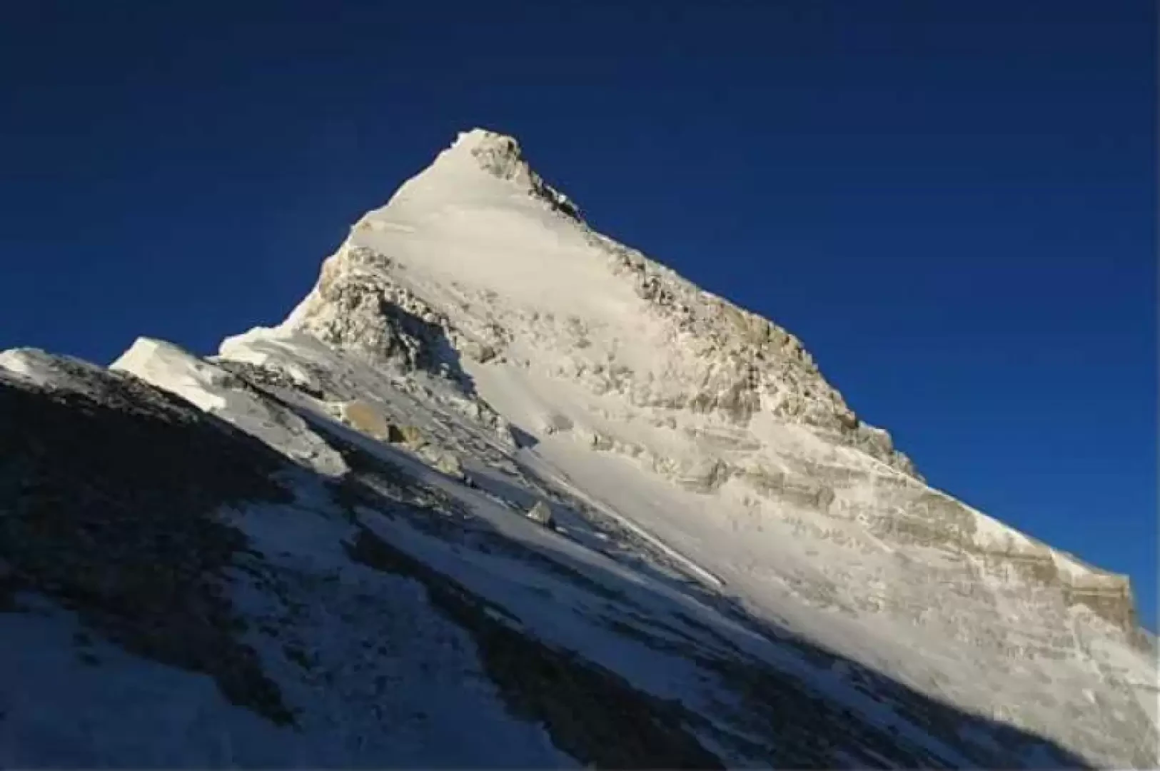
The mountain has the shape of a pyramid with three faces – north, south-west and east – separated by three main ridges. The south-eastern and north-eastern ridges form the routes of the two standard ascents, established respectively by the British expedition of 1953 and the Chinese expedition of 1960. The Nepalese side lies within the Sagarmatha National Park, a UNESCO World Heritage Site, whilst the Tibetan side lies within a Chinese protected area.
In addition to its Western name, the mountain is known as Chomolungma in Tibetan and Sagarmatha in Nepali. It is the highest point in Asia, Nepal and China, and forms part of the Seven Summits.
Description
Three ridges branch off from the summit. The south-east ridge descends to the South Col (7,906 m), which separates Everest from Lhotse (8,516 m); the north-east ridge descends towards the North Col (7,066 m) and Changtse (7,543 m); the west ridge reaches Lho La (6,026 m), beyond which rises Khumbutse. The border between Nepal and China follows the western and south-eastern ridges: the south-western face lies entirely within Nepal, whilst the northern and eastern faces are in Chinese territory. Three glaciers drain the slopes: the Khumbu to the south-west, which originates in the Western Cwm between Everest, Lhotse and Nuptse and descends through a field of seracs towards Lobuche and Pheriche; the Rongbuk to the north, with its eastern, central and western branches; and the Kangshung to the east, at the foot of the face of the same name.
The official height of 8,848.86 m was jointly announced by Nepal and China on 8 December 2020, following summit measurements carried out by the two national teams in 2019 and 2020; this figure includes the snow cap. Previously, Nepal had used 8,848 m and China, since 2005, 8,844.43 m, both referring to the rock surface.
The mountain’s structure bears witness to the collision between the Indian and Eurasian tectonic plates, which began around 50 million years ago and is still ongoing. From the summit down to around 8,600 metres, the Qomolangma Formation is exposed: Ordovician limestones deposited on the floor of the Tethys Ocean, containing marine fossils. Below, down to around 7,000 metres, lies the North Pass Formation, comprising marbles, phyllites and schists; this includes the Yellow Band, the layer of yellowish marble traversed by both standard routes. Further down, the gneisses and two-mica granites of the Rongbuk Formation outcrop. The three units are separated by low-angle faults: the Qomolangma detachment and the Lhotse detachment. Following the earthquake on 25 April 2015, mountaineers observed that the rocky ledge known as the Hillary Step, below the summit, had disappeared and been replaced by a snow slope.
The Nepalese side forms part of Sagarmatha National Park, established on 19 July 1976 over an area of 1,148 km² in the Solukhumbu district and inscribed on the UNESCO World Heritage List in 1979. The park covers the upper basin of the Dudh Koshi; to the north it borders the Chinese Qomolangma Protected Area, and to the east the Makalu-Barun National Park. Mammals found in the park include the snow leopard (Panthera uncia), the red panda (Ailurus fulgens), the Himalayan musk deer (Moschus leucogaster) and the Himalayan tahrHemitragus jemlahicus); among the birds, the monal (Lophophorus impejanus). At lower altitudes within the park, there are forests of fir, birch, rhododendron and juniper; above 5,000 metres, the vegetation is reduced to mosses and lichens.
The Western name was proposed in 1856 by Andrew Waugh, director of the Great Trigonometrical Survey of India, in honour of his predecessor George Everest; the Royal Geographical Society officially adopted it in 1865. In the Survey’s records, the mountain was listed as Peak XV; in 1852, calculations by the mathematician Radhanath Sikdar identified it as the highest peak measured at that time. The Tibetan name Chomolungma, known in Chinese as Qomolangma, is usually translated as ‘Mother Goddess of the World’; the Nepalese name Sagarmatha, adopted in the 20th century, as ‘forehead of the sky’. Both translations are common interpretations and do not have a single, definitive form.
The first British expeditions ascended from Tibet, as Nepal was closed to foreigners. The 1921 reconnaissance expedition, led by Charles Howard-Bury, identified the route via the North Col. In 1922, George Finch and Geoffrey Bruce, using oxygen, reached an altitude of approximately 8,320 metres; the same expedition lost seven porters in an avalanche below the North Col. On 8 June 1924, George Mallory and Andrew Irvine set off for the summit and never returned; Noel Odell saw them for the last time on the north-east ridge. Mallory’s body was found in 1999 at an altitude of approximately 8,150 m on the north face; in September 2024, a National Geographic team found a mountaineering boot with the remains of a foot and a sock bearing Irvine’s name on the Central Rongbuk Glacier. The pair’s camera was never found, and the question of whether they actually reached the summit remains unresolved.
With the opening up of Nepal in 1951, attention shifted to the south face. In 1952, Edouard Wyss-Dunant’s Swiss expedition took Raymond Lambert and Tenzing Norgay to around 8,595 metres on the south-east ridge. The following year, the British expedition led by John Hunt reached the summit on 29 May 1953 with Edmund Hillary and Tenzing Norgay at 11.30; the news reached London on 2 June, the day of Queen Elizabeth II’s coronation. On 25 May 1960, a Chinese expedition made the first ascent via the north face. On 22 May 1963, Tom Hornbein and Willi Unsoeld climbed via the West Ridge and the couloir named after Hornbein, and descended via the South Col, completing the first traverse of the mountain. In 1973, the Italian expedition led by Guido Monzino took Rinaldo Carrel and Mirko Minuzzo to the summit on 5 May and three other mountaineers on 7 May. On 16 May 1975, the Japanese climber Junko Tabei became the first woman to reach the summit; on 24 September of the same year, Doug Scott and Dougal Haston, as part of Chris Bonington’s expedition, completed the first ascent of the south-west face.
On 8 May 1978, Reinhold Messner and Peter Habeler reached the summit via the South Col without supplementary oxygen. On 17 February 1980, the Poles Krzysztof Wielicki and Leszek Cichy, as part of the expedition led by Andrzej Zawada, made the first winter ascent – the first ever on an eight-thousander. On 20 August 1980, Messner returned to the summit alone and without oxygen via the north face, traversing from the north-east ridge to the Norton Couloir. In 1983, a US expedition made the first ascent of the east face.
Since the 1990s, commercial expeditions have become the predominant form of ascent. Eight mountaineers died on the mountain during the storm of 10–11 May 1996; the 2023 season, with eighteen fatalities, is the deadliest on record. According to the Himalayan Database, by the end of 2025 there had been 13,737 summit ascents, more than half of which were completed by Sherpas and high-altitude support staff. On 17 May 2026, Kami Rita Sherpa, born in Thame in the Khumbu region, reached the summit for the thirty-second time, an all-time record; on the same day, Lhakpa Sherpa extended her record for women to eleven.
For the Sherpa communities of the Khumbu, the mountain is a sacred place. Before setting off, expeditions hold a puja at base camp – a Buddhist ceremony officiated by a lama – to pray for the protection of climbers and porters. Edmund Hillary founded the Himalayan Trust in 1960, which has built schools and health centres in the villages of the Khumbu.
In Lobuche, in the Khumbu Valley, the Piramide Laboratory is situated at 5,050 metres; this high-altitude research centreset up in 1990 by the Italian Ev-K2-CNR committee on the initiative of Ardito Desio and Agostino Da Polenza, dedicated to studies of climate, the environment and physiology. The project is also responsible for the South Col weather station, installed in 2008 at an altitude of approximately 8,000 metres, and the webcam trained on the summit.
Information
General information
Elevation: 8,849 m (8,848.86 m, joint Nepal–China survey of 2020)
Alternative names: Sagarmatha (Nepali), Chomolungma (Tibetan), Qomolangma or Zhumulangma (Chinese), Peak XV (historical)
Mountain range: Mahalangur Himal, Central Himalayas
First ascent: 29 May 1953 - Edmund Hillary, Tenzing Norgay
First winter ascent: 17 February 1980 - Krzysztof Wielicki, Leszek Cichy
Municipalities: Khumbu Pasang Lhamu Rural Municipality (Solukhumbu District, Nepal) – Tingri County (Shigatse, Tibet Autonomous Region, China)
Valleys: Khumbu Valley (Nepal) – Rongbuk Valley (China)
Climbing difficulty: PD (south-east ridge), PD+ (north-east ridge), ED (south-west and east faces)
Average elevation gain: 3,485 m (from South Base Camp)
Recommended period: late April – late May
Glaciers present: yes (Khumbu, Rongbuk, Kangshung)
Equipped sections: yes (fixed ropes on both standard routes, ladder on the Second Step)
Protected area: Sagarmatha National Park (Nepal, a UNESCO World Heritage Site since 1979), Qomolangma National Protected Area (China)
Support facilities
There are no managed mountain huts on the mountain. Support facilities consist of expedition camps: on the Nepalese side: South Base Camp (5,364 m), Camp I above the Khumbu Icefall, Camp II in the Western Cwm, Camp III on the Lhotse Face and Camp IV at the South Col (7,906 m); on the Tibetan side: North Base Camp (5,200 m), the Advanced Base Camp (approximately 6,400 m), the camp at the North Col (7,066 m) and the higher camps on the North Ridge. Along the trek on the Nepalese side, the lodges in the villages of the Khumbu region, as far as Gorak Shep (5,164 m), provide board and lodging.
Visas and permits
Nepal climbing permit: Department of Tourism; for the standard southern route, US$15,000 per person in spring (March–May), US$7,500 in autumn, 3,750 in winter and during the monsoon season (rates valid from 1 September 2025)
compulsory guide in Nepal: one guide for every two mountaineers on eight-thousanders (mountaineering regulationsMountaineering Regulations of 2025)
Climbing permit for China: issued by the China Tibet Mountaineering Association only to organised expeditions, with oxygen and services included in a package; in spring 2026, the north face was closed to foreign mountaineers
visas and permits for Tibet: Chinese visa, Tibet travel permit and border area permit, obtained through theorganising agency
protected area: entry to Sagarmatha National Park is subject to a fee, with checks at Monjo