Alagna Valsesia

Edited by:
Massimo Martini
Access
The town can be reached via the [A26] motorway (Genoa Voltri–Gravellona Toce), taking the Romagnano Sesia-Ghemme exit, or via the [A4] Turin–Milan motorway to the Biandrate junction, where you join the [A26]. From the toll booth, the Valsesia road runs the entire length of the valley for approximately 65 km, passing through Varallo, Balmuccia, Scopello, Scopa, Mollia, Campertogno, Piode and Riva Valdobbia before reaching Alagna. The municipality does not have its own railway station: the nearest stations are Novara and Vercelli, served by Trenitalia (TI) on the Turin–Milan line. Local public transport is provided by ATAP S.p.A., operating the Vercelli–Gattinara–Borgosesia–Alagna route, and by Baranzelli, with services from Novara via Varallo; during the winter months (December–March), a seasonal shuttle service operates from Varallo. The nearest major airport is Milan’s ‘Malpensa’. In winter, the requires winter tyres or snow chains to be carried on board for the upper valley section, with possible restrictions in the event of heavy snowfall.
Introduction
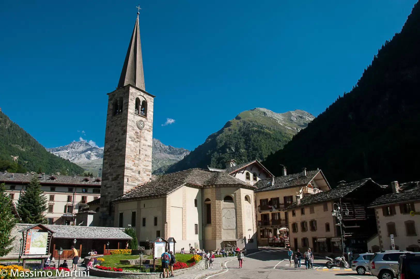
Alagna Valsesia is situated at the head of the Valsesia valley, in the province of Vercelli, at the foot of the southern slope of the Monte Rosa massif. The village, of Walser origin, lies in the Val Grande, at the confluence of the valleys that descend from the Monte Rosa massif towards the upper reaches of the River Sesia. Since 2019, the municipality has also included the territory of the former municipality of Riva Valdobbia and the Val Vogna, its side valley leading towards the Aosta Valley. The altitude range of the municipal territory is among the widest in the Western Alps, stretching from around 985 metres at the valley floor up to the summit ridges of Monte Rosa, at over 4,500 metres. The territory borders to the north and west on the watershed ridge that marks the national border with Switzerland. Its identity remains shaped by Walser culture, agro-pastoral traditions and, more recently, mountaineering and skiing tourism linked to the Monterosa Ski area.
Description
The municipal area stretches along two main valleys that converge in the upper Valsesia: the Val Grande, through which the upper reaches of the River Sesia flow, and the Val Vogna, a side valley which, until 2019, belonged to the municipality of Riva Valdobbia. The highest points in the municipality lie on the summit ridge of Monte Rosa, where Punta Gnifetti (4,554 m), Grenzgipfel (4,618 m), Punta Parrot (4,432 m) and Punta Giordani (4,046 m); the Sesia, Piode, Vigne and Indren glaciers cover the northern side of the municipality, whilst alpine lakes such as Lake Cortese are situated at high altitude in Val Vogna.
The settlement of the area by the Walser people, who arrived from the Upper Valais region of Switzerland, dates back to the 13th century; Alagna and Riva Valdobbia once formed a single community, known as Pietre Gemelle, united within a single parish. The area had a small-scale mining economy, linked to manganese deposits in the Val d’Otro area. Between the late 19th and early 20th centuries, the development of tourism led to the construction of Art Nouveau villas; the first ski facilities date back to the 1960s. On 1 January 2019, the municipality of Riva Valdobbia was incorporated into Alagna Valsesia under Piedmont Regional Law No. 25/2018.
The modern economy is centred on mountain tourism: the Monterosa Ski area, shared with the Aosta Valley municipalities of Gressoney-La-Trinité and Ayas, is one of the largest in the Alps for off-piste and freeride skiing. Alongside tourism, an agro-pastoral economy based on alpine grazing and dairy production continues to thrive. Walser culture is documented in the Walser Museum in the hamlet of Pedemonte and in the Valsesia Ecomuseum; among the religious traditions, the ‘Rosario Fiorito’ – a procession of Walser origin – is still observed. Traditional architecture in wood and stone (using the ‘blockbau’ technique) characterises the municipality’s historic hamlets.
Much of the municipal territory falls within the Alta Val Sesia and Alta Val Strona Nature Park, established in 1979 and one of Europe’s highest-altitude protected areas. The vegetation varies according to altitude: beech and silver fir forests at lower altitudes, larch forests and alpine meadows higher up, and pioneer species such as genepì and gentian at the highest altitudes, with shrublands of rhododendron (Rhododendron ferrugineum) and blueberry. Notable fauna include the ibex (Capra ibex, reintroduced to Valsesia in the 1970s), the chamois (Rupicapra rupicapra), the Alpine marmot (Marmota marmota), the golden eagle (Aquila chrysaetos) and the bearded vulture (Gypaetus barbatus), which has returned to breed in the protected area; other birds of the alpine environment include the black grouse, the rock ptarmigan and the rock partridge.
Alagna Valsesia is the starting point for routes to the mountain huts on the southern slope of Monte Rosa, including the Capanna Giovanni Gnifetti, the Rifugio Città di Vigevano, the Abate Antonio Carestia Mountain Hut and the Barba-Ferrero Mountain Hut, as well as a stop on long-distance hiking routes around the massif. The municipal network of footpaths includes the routes in Val d’Otro and, in the territory of the former Riva Valdobbia, those in Val Vogna; ski mountaineering and freeriding are practised in the Monterosa Ski area.
Information
Area: 72.00 km²
Altitude: 1,154 m
Highest point: Punta Gnifetti (4,559 m)
Population: 431
Name in the local dialect: Im Land
Name of inhabitants: Alagnesi
Patron saint: St John the Baptist (24 June)
Website: www.comune.alagnavalsesia.vc.it
Webcam: www.freerideparadise.it/webcam.asp
Neighbouring municipalities: Gressoney-La-Trinité, Macugnaga, Alto Sermenza, Riva Valdobbia, Zermatt
Villages and hamlets: Dorf, Fum d’Boudma, Fum Diss, Fum Tschukke, Fun d’Rùfinu, Im Adelstodal, Im Felleretsch, Im Garrài, Im Oubre Grobe, Im Oubre Rong, Im Rong, Im Undre Grobe, Im Wold, In d’Bundu, In d’Ekku, In d’Follu, In d’Mèrlette, In d’Stütz, In d’Weng, In d’Wittine, Purratz Hus, Scarpia, Uttershus, Wittwosma, Z’am Steg, Zar Chilchu, Zar Sogu, Z’Jakmuls Hus, Z’Kantmud, Z’Pudelenn, Z’San Niklòs, Z’Yuassis Hus
Mountain pastures: